
FURUNO GPS
Furuno’s GP170 is a highly stable and reliable position fixing system for ocean going ships, large yachts, ferries and commercial vessels. It is an ideal position sensor for Radar, AIS, ECDIS, Autopilot, Echo Sounder and other navigation and communications equipment. Its newly designed GPS chip and antenna deliver enhanced stability and precision in position fixing. Noise rejection capabilities are incorporated in the new receiver, delivering a high level of tolerance towards multi-path mitigation, which is further enhanced when the GPA020S or GPA021S antenna unit is utilized.
The GP170 is BAM (Bridge Alert Management) ready and boasts a variety of display modes, including Plotter, Course, Highway, Data and Integrity. The Integrity display mode delivers a highly accurate Skyplot presentation of currently viewable satellites, status on GNSS/SBAS signal reception including strength and SNR, and elevation angles of available satellites, as well as detailed information about available beacon stations.
Product Details
FEATURES
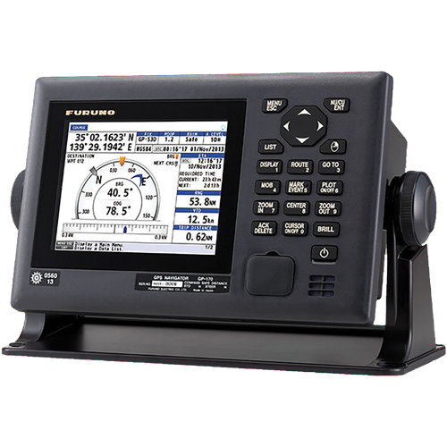
FURUNO GPS – GP-170
- Accurate Positioning: Provides precise latitude, longitude, and speed data for safe navigation in coastal and offshore waters.
- Multi-Constellation Support: Uses GPS satellites for reliable positioning; compatible with augmentation systems like DGPS for improved accuracy.
- Compact & Durable: Small, lightweight design suitable for vessels of all sizes with marine-grade durability.
- Easy Integration: Outputs NMEA 0183 data for seamless connection with chart plotters, radar, autopilot systems, and other navigation instruments.
- Quick Startup & Reliable Operation: Fast satellite acquisition and stable operation even in challenging environments.
SPECIFICATION
| Position Accuracy | ±10 m (without DGPS), ±3 m (with DGPS) |
| Output / Interfaces | NMEA 0183 |
| Update Rate | 1 Hz (standard), 5 Hz optional |
| Power Supply | 12 V DC |
| Dimensions | Compact and lightweight |
| Data Provided | Position (latitude/longitude), speed over ground (SOG), course over ground (COG), time |
| Maintenance | Maintenance-free, robust design |